The best mountains in Vietnam range from Fansipan, a 3,143 m summit above Sapa, to the limestone peaks of Cao Bang and the pine plateaus around Da Lat. Some are climbs, some are road journeys through karst country, and some are pilgrimage routes where a cable car handles the final stretch. This guide covers twelve of them from north to south, separating true summits from wider mountain regions. Each entry carries an effort level and a realistic travel window, based on access rules in force in 2026.

Vietnam’s Mountains Compared by Elevation, Effort and Season
| Mountain or region | Province or city | Elevation | Experience | Effort | Prime months |
|---|---|---|---|---|---|
| Fansipan | Lao Cai | 3,143 m | Summit by cable car or trek | Low by cable car, high on foot | Autumn to early spring |
| Pu Si Lung | Lai Chau | About 3,076 m | Multi-day expedition | High | October to March |
| Lao Than | Lao Cai | 2,860 m | Cloud-hunting trek | Moderate to high | September to November |
| Ta Xua | Son La | Highland ridge | Ridge trek, cloud viewing | High on the ridge | October to March |
| Dong Van Karst Plateau | Tuyen Quang (Ha Giang) | Plateau and passes | Mountain road journey | Long driving days | Spring and autumn |
| Cao Bang and Angel’s Eye | Cao Bang | Limestone peaks | Karst, waterfalls, caves | Low to moderate | Summer for waterfall flow |
| Pu Luong | Thanh Hoa | About 1,700 m | Village and terrace walks | Low to moderate | September to May |
| Yen Tu | Quang Ninh | 1,068 m | Pilgrimage climb | Low by cable car | Cooler months |
| Bach Ma | Hue | 1,450 m | Rainforest hiking | Moderate | February to September |
| Marble Mountains | Da Nang | About 106 m | Caves and pagodas | Low | February to July |
| Lang Biang | Lam Dong | 2,167 m | Highland views | Low to moderate | December to March |
| Ba Den | Tay Ninh | 986 m | Temple route, cable car | Low to moderate | November to March |
What Shapes Vietnam’s Mountain Landscapes?
The country’s relief changes sharply from one region to the next. In the northwest, the Hoang Lien Son range carries summits above 3,000 m, and its valleys hold the terraced rice fields that define many northern itineraries. The northeast turns to limestone karst: jagged peaks, deep gorges and a plateau landscape recognised by UNESCO. Further south, the Central Highlands open into cool pine plateaus, while the far south offers isolated massifs that rise abruptly from flat land and have long been sacred ground.
Three kinds of experience recur throughout this guide. Summit climbing rewards fitness and preparation. Trekking links ridgelines, villages and homestays over one to several days. Scenic road travel, as on the Ha Giang Loop, makes the journey itself the destination.
Which Mountain Is the Highest in Vietnam?
Fansipan, at 3,143 m, is the highest mountain in Vietnam and in all of Indochina. A cluster of Hoang Lien Son peaks above 3,000 m follows it, among them Pu Si Lung in Lai Chau. Published elevations for these neighbours vary slightly between sources, which is why this guide avoids strict rankings below the first place.
Northern Vietnam: Highland Peaks, Karst Plateaus and Terraced Valleys
The north holds the densest concentration of mountain experiences in the country, from 3,000 m summits to plateau roads cut into limestone. Eight destinations follow. For route planning, durations and combinations across the region, our northern mountains guide goes into far more detail.
1. Fansipan: Reaching the Roof of Indochina
- Location: Sapa, Lao Cai Province
- Elevation: 3,143 m
- Experience: summit by cable car or guided trek
- Effort: low by cable car, high on foot
- Best months: autumn to early spring
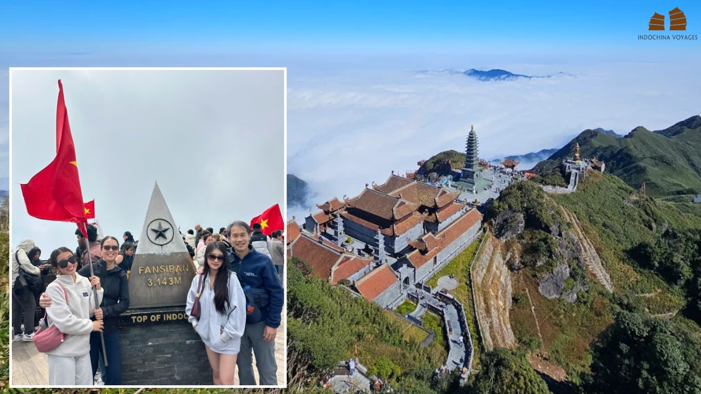
Fansipan is the mountain most visitors have in mind when they ask about Vietnam’s peaks, and two very different experiences lead to the same summit.
The cable car covers roughly 6.3 km in about 15 minutes and gains more than 1,400 m of height between stations. In 2026 an adult round-trip ticket costs 850,000 VND, around US$34, while the Muong Hoa monorail and the funicular on the upper section are priced separately. A short stair climb completes the ascent.
The traditional trek takes two to three days over steep, often muddy ground, with an overnight stop on the mountain. It is not the cable car with extra steps. It is a separate undertaking that calls for real fitness and local guiding.
Conditions at the top differ sharply from Sapa town. Temperatures can fall below freezing in winter, and cloud tends to build after mid-morning, so an early start gives the best chance of open views.
Travelers who prefer valleys to summits can walk the Muong Hoa Valley through Lao Chai and Ta Van, a three-to-four-hour route past terraces and family homes. Our guide to Sapa off the beaten track suggests quieter alternatives.
Specialist’s note: ride early in the day, and treat any clear view as a bonus rather than a promise.
>>>> Related tour: Exploring Sapa, 3 Days by Land → Valley trek and Fansipan cable car in one trip.
2. Sapa’s Valleys: Rice Terraces and Trekking
- Key areas: Muong Hoa Valley, Lao Chai, Ta Van and Ta Phin
- Experience: half-day and full-day treks, village visits and homestays
- Effort: low to moderate, depending on the route
- Best months: late August to October for golden terraces
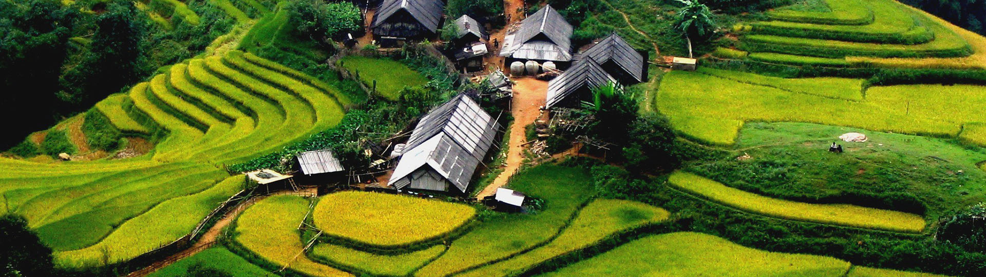
Many visitors come to Sapa for the valleys beneath Fansipan rather than for the summit itself. The Muong Hoa Valley holds the area’s most extensive terraces, and the villages of Lao Chai and Ta Van, home to H’mong and Dzay communities, lie along its classic walking route of three to four hours. Ta Phin offers a different trail away from that main corridor.
Terrace color follows the growing cycle: flooded and reflective in early summer, deep green in July and gold at harvest. Golden tones arrive in Sapa from late August, with mid-September strongest for photography, although timing shifts from year to year.
Accessibility varies widely. A gentle guided walk follows broad valley paths, while longer routes involve steep sections, uneven ground and mud after rain. The valleys suit travelers who prefer exploring on foot, families seeking manageable walks, and visitors who want a comfortable base with a choice of accommodation.
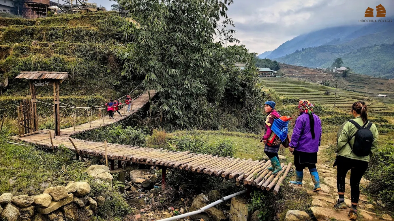
Specialist’s note: choose a trek by trail conditions and fitness rather than distance alone, since a short mountain walk can still involve significant elevation change. Our guide to Sapa off the beaten track suggests quieter routes.
Related tour: Exploring Sapa, 3 Days by Land → Valley trek and Fansipan cable car in one trip.
3. Ha Giang: Mountain Passes and the Dong Van Karst Plateau
- Location: Ha Giang, now part of Tuyen Quang Province
- Landscape: limestone plateau and mountain passes
- Experience: road journey by motorbike or private car
- Effort: long driving days rather than climbing
- Best months: spring and autumn
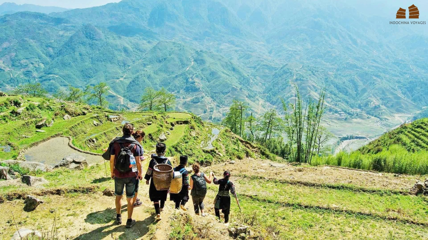
The Dong Van Karst Plateau is a UNESCO Global Geopark, a high rocky landscape of limestone peaks, deep gorges and villages built into the stone. The appeal lies in the road rather than a single summit.
Key stops
Quan Ba and its Twin Mountains open the route, and Ma Pi Leng Pass is the signature stretch, a cliff road above the Nho Que River gorge. Dong Van and Meo Vac hold Sunday markets that draw people from surrounding villages, and homestays nearby offer a way to learn about the communities who farm these slopes. Lung Cu, with its flag tower, marks Vietnam’s northernmost point; it is a landmark, not a mountain peak.
How to travel the loop
The loop runs about 300 to 350 km and usually takes three to four days. Travelers can ride themselves, hire an easy rider or go by private car. The route suits road-trip enthusiasts and landscape photographers who are comfortable with long travel days.
Permits and licences
Foreign visitors need a Border Area Permit for the northern districts, at around 250,000 VND, and checks have tightened since mid-2026. Self-riders also need a motorcycle licence from home and a 1968-convention International Driving Permit.
Seasons and weather
Pear and bauhinia blossom runs from February to April, and buckwheat flowers bloom from late September to early December. Fog and rain can erase views and make bends hazardous.
Specialist’s note: do not treat photogenic roads as proof of an easy ride. A licensed local driver or rider is the safer choice for anyone without extensive mountain experience. Our Ha Giang Loop guide explains the options, while Ha Giang as an alternative to Sapa compares the two regions.
>>>> Related tour: Explore Unfold Ha Giang, 5 Days → Permits, drivers and homestays arranged for you.
4. Cao Bang: Angel’s Eye Mountain and the Non Nuoc Geopark
- Location: Cao Bang Province, on the Chinese border
- Landscape: limestone peaks within a UNESCO Global Geopark
- Experience: karst scenery, waterfalls and caves
- Effort: low to moderate
- Best months: summer for waterfall flow
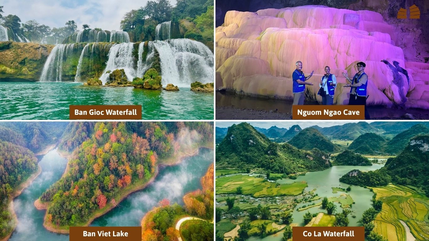
Cao Bang sits on the Chinese border within the Non Nuoc Cao Bang UNESCO Global Geopark. Its signature mountain is Angel’s Eye, known locally as Nui Thung, a limestone peak pierced by a natural opening; tour operators describe the hole as roughly 50 m wide, set high above a valley of grassland and seasonal lakes.
Around it lie Ban Gioc Waterfall, shared with China and fullest after summer rains; Nguom Ngao Cave, a lit system of stalactite chambers close to the falls; and Phong Nam Valley, a quiet stretch of rice fields beneath karst peaks. Pac Bo adds historical context for those with time to spare.
Cao Bang is five to seven hours from Hanoi, and two to three days covers the highlights, while three to four allows a fuller route. A night near Ban Gioc beats a rushed day trip from Cao Bang City. Fewer hotels, longer transfers and the need to carry a passport near the border all call for planning ahead. Calling the region untouched would be inaccurate, but it is considerably quieter than Sapa or the Ha Giang Loop.
Cao Bang suits nature enthusiasts, photographers and travelers who prefer quieter roads and want to pair landscapes with local history.
Our Cao Bang travel guide covers the highlights in detail.
>>>> Related tour: Spirit of Northeast Vietnam Adventure, 7 Days → Ha Giang, Cao Bang and Ba Be Lake in one journey.
5. Lao Than: Above the Clouds at Y Ty
- Location: near Y Ty, Lao Cai Province
- Elevation: 2,860 m
- Experience: overnight cloud-hunting trek
- Effort: moderate to high
- Best months: September to November
Lao Than has earned its reputation among cloud hunters. From the summit ridge, dawn light can spread across a sea of cloud with the Hoang Lien Son range beyond it. The trek is usually done overnight, with a pre-dawn start on steep, uneven trails and a sturdy pair of boots as the one non-negotiable item.
Autumn and early winter are the favoured seasons, although cloud formation cannot be guaranteed on any given morning. Local guides and porters handle camping gear and homestay arrangements in the area, and a warm sleeping bag matters more than most visitors expect.
For travelers who want mountain time on foot rather than a long road circuit, Lao Than is the natural alternative to Ha Giang.
6. Ta Xua: Ridge Lines and the Dinosaur’s Spine
- Location: Bac Yen District, Son La Province
- Experience: dawn cloud viewing and ridge trekking
- Effort: strenuous on the ridge
- Best months: October to March
Ta Xua is known for dawn cloud that fills the valleys and leaves the ridgeline, including the formation nicknamed the Dinosaur’s Spine, standing above it. The approach is long: five to six hours by road from Hanoi to Bac Yen, then about 45 minutes uphill, and a private car makes this far easier.
The ridge treks are strenuous, and the surrounding H’mong villages add cultural interest. Where Lao Than is built around an overnight summit push, Ta Xua suits travelers who want viewpoints and ridge walking with a flexible schedule.

7. Pu Si Lung: A Border Summit for Seasoned Trekkers
- Location: Lai Chau Province, near the Chinese border
- Elevation: about 3,076 m
- Experience: multi-day expedition with camping
- Effort: high
- Best months: October to March
Pu Si Lung rises in the remote far northwest, close to the Chinese border, and ranks among the most demanding climbs open to visitors. The route crosses dense forest and steep terrain over several days, with camping on the mountain.
Access requires permits, authorized local support and experienced guides, and conditions can change from season to season. Nothing here resembles the cable-car convenience of Fansipan. Travelers drawn to the idea should plan the expedition with a specialist who handles approvals directly; our team can build one through a custom itinerary.
8. Pu Luong: Terraces, Stilt Houses and Gentle Ridge Walks
- Location: Thanh Hoa Province
- Elevation: about 1,700 m
- Experience: village and terrace walks
- Effort: low to moderate
- Best months: September to May
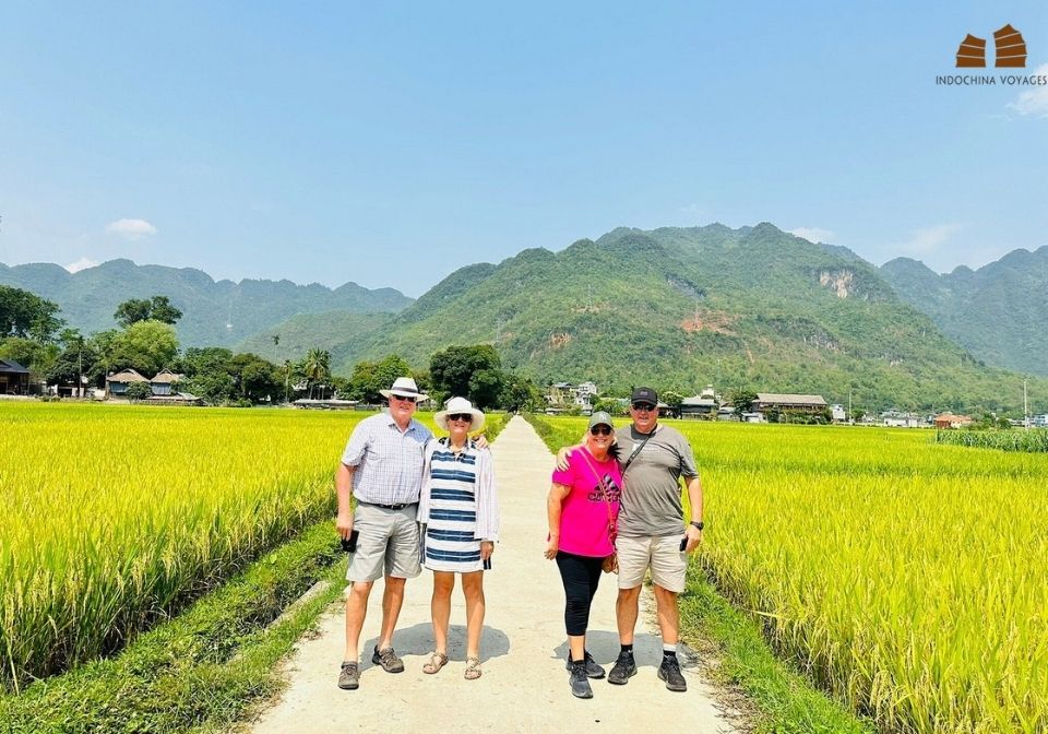
Pu Luong is a nature reserve and mountain landscape rather than a single peak. Rice terraces step down valley sides, Thai stilt houses cluster along the trails, and bamboo water wheels still turn in the streams.
Guided village walks here are gentle and flexible, a world apart from summit treks. Terrace color follows the growing cycle, shifting from flooded and reflective to deep green and finally gold, and an overnight stay lets you see the valleys in both evening and morning light.
For travelers who prefer a slower rural rhythm, Pu Luong fits naturally into a northern itinerary. Read our Pu Luong travel guide for trail and homestay ideas.
Related tour: Exclusive Trip Pu Luong to Ninh Binh, 4 Days → Mountain scenery followed by Ninh Binh’s karst landscape.
9. Yen Tu: A Pilgrimage Peak Within Reach of Hanoi
- Location: Quang Ninh Province
- Elevation: 1,068 m
- Experience: pilgrimage climb
- Effort: low by cable car, moderate on foot
- Best months: cooler months
Yen Tu is the birthplace of Truc Lam Zen Buddhism, the tradition founded by King Tran Nhan Tong after he gave up the throne. The site gained UNESCO World Heritage status in 2025, and the summit is crowned by the Dong Pagoda at 1,068 m.
Two cable-car routes serve the Quang Ninh side, and a final stretch of stone steps reaches the top. The journey from Hanoi takes about three hours, which makes Yen Tu one of the most accessible mountain experiences from the capital. The quieter Tay Yen Tu side offers newer facilities and less crowded trails.
Expect weekend crowds, modest dress requirements at the temples and a pace that suits reflection more than athletic effort.
Central Vietnam: Rainforest Ridges and Coastal Hills
10. Bach Ma: Cloud Forest and Waterfalls above Hue
- Location: Hue City (formerly Thua Thien Hue)
- Elevation: 1,450 m
- Experience: rainforest hiking
- Effort: moderate
- Best months: February to September
Bach Ma National Park preserves a forested massif that began life as a French hill station; the ruined villas still stand among the trees. Hiking routes lead to waterfalls and viewpoints, and the park shelters considerable biodiversity.
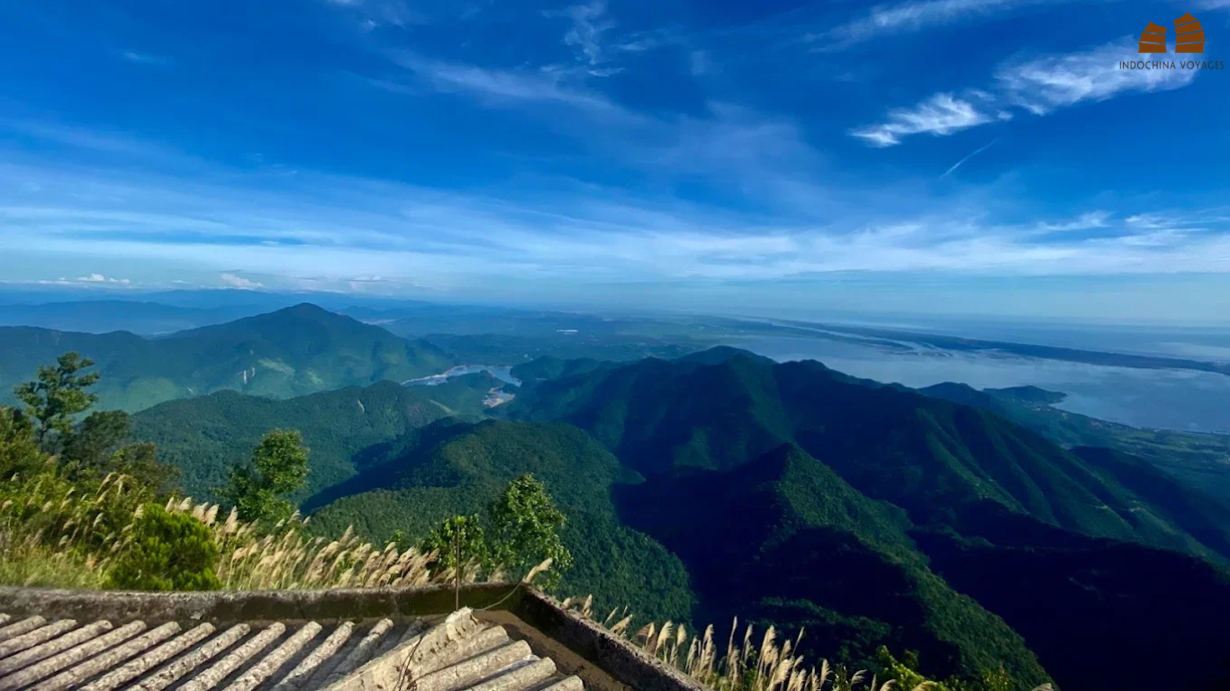
The mountain catches heavy weather, so check park access, trail conditions and the forecast before departure. For travelers based in central Vietnam who want a nature-focused day away from the coast, it is the strongest option. See our Bach Ma National Park guide for details.
11. Marble Mountains: Caves, Pagodas and City Views
- Location: Da Nang
- Elevation: about 106 m
- Experience: caves, pagodas and city views
- Effort: low
- Best months: February to July
The Marble Mountains are five limestone-and-marble outcrops rising from the Da Nang coastal plain, named after natural elements. They are cultural sites rather than a trekking destination, with cave sanctuaries, pagodas and viewpoints over the city and shoreline.
Plan one to two hours, and combine the visit with Hoi An. Stairs, midday heat and slippery stone call for sturdy footwear and an early start, and temple etiquette applies throughout.
Central Highlands and Southern Vietnam: Pine Plateaus and Sacred Peaks
12. Lang Biang: Pine Highlands above Da Lat
- Location: Lam Dong Province, above Da Lat
- Elevation: 2,167 m
- Experience: highland views by jeep or on foot
- Effort: low to moderate
- Best months: December to March
Lang Biang overlooks Da Lat and its surrounding flower farms from a cool, pine-covered massif. Access depends on the route and current rules: organised jeep transfers cover the upper section for most visitors, while trekkers can tackle the longer approach on foot.
The cool highland air, forest scenery and panoramic views suit couples and families already spending time in Da Lat, the old French hill station.
13. Ba Den: Tay Ninh’s Sacred Summit
- Location: Tay Ninh Province
- Elevation: 986 m
- Experience: temple route and cable car
- Effort: low to moderate
- Best months: November to March
Ba Den, the Black Virgin Mountain, is a major pilgrimage site, with temples and pagodas strung up its flanks. Visitors can walk the temple complex, ride a cable car or hike the full ascent, and it works as a day trip from Ho Chi Minh City.
Festival periods bring heavy crowds, so a midweek visit is calmer. Dress modestly, and keep a respectful distance at worship areas.
Also in the South: Ta Cu and Sam Mountain
Ta Cu, at 649 m in what is now Lam Dong Province, is known for a giant reclining Buddha and ancient temples, with a cable car beside the hiking trail. Sam Mountain, only 284 m, rewards a sunset visit with views over the Mekong Delta and across the border toward Cambodia; a stop in Chau Doc pairs naturally with it.
Sapa, Ha Giang or Cao Bang: Which Mountain Destination Should You Choose?
These three northern destinations are not interchangeable, and the comparison below turns the descriptions above into a decision.
| Factor | Sapa | Ha Giang | Cao Bang |
|---|---|---|---|
| Main appeal | Trekking, rice terraces and Fansipan | Mountain passes and karst plateaus | Waterfalls, caves and karst valleys |
| Best way to explore | Walking, guided treks and the cable car | Guided motorbike trip or private car | Private car, guided road trip or a suitable motorbike tour |
| Physical demand | Flexible, depending on the trek | Long road days; riding requires confidence and care | Flexible, with road travel and walking excursions |
| Travel style | Established tourism infrastructure | Adventure-focused road trip | Quieter, more spread-out rural exploration |
| Suggested time | 2–3 days | 3–4 days | 3–4 days |
| Best for | Walkers and first-time mountain visitors | Road-trip enthusiasts and landscape photographers | Nature lovers and travelers seeking a less crowded route |
- Sapa fits travelers who want to trek through terraced valleys and keep flexible accommodation choices.
- Ha Giang rewards those who want a journey dominated by dramatic mountain passes and are comfortable with extended road travel.
- Cao Bang appeals when waterfalls, limestone landscapes and a quieter itinerary matter more than the social atmosphere of a popular motorbike circuit.
Durations are planning guidance, to be adjusted for transport schedules, overnight travel and your own pace. The right choice depends on whether you want to walk through the mountains, travel across them or explore their natural landmarks.
How Demanding Is Each Mountain? Effort Levels Explained
Little or no hiking. The cable-car routes at Fansipan, Ba Den and Ta Cu, plus the Marble Mountains, require only comfortable shoes and the ability to climb stairs.
Half-day to full-day walks. Lang Biang, Pu Luong, Yen Tu on foot, Bach Ma, Sam and the Muong Hoa Valley suit most reasonably active travelers. A basic level of fitness, sturdy footwear and a daypack are enough, although a local guide improves route choice and cultural insight.
Multi-day and guided. The Fansipan trek, Lao Than, the Ta Xua ridge and Pu Si Lung belong in a separate category. Altitude, cold nights, camping and steep terrain demand training beforehand and experienced local support.
Road-based effort. Dong Van and Cao Bang are a different case, because the exertion lies in long driving days on winding roads, not in climbing. Motion sickness, fatigue and weather delays matter more than fitness.
When to Visit: Season by Mountain Region
| Region | What shapes the visit | Best windows |
|---|---|---|
| Northwest (Sapa, Lao Than, Ta Xua) | Terraces turn gold from late August, cloud season runs October to March, Sapa winter lows average about 6°C | September to November for color, October to March for clouds |
| Northeast (Dong Van, Cao Bang) | Blossom from February to April, buckwheat to early December, strongest Ban Gioc flow in summer | Spring and autumn for roads, summer for waterfalls |
| Hanoi-adjacent (Pu Luong, Yen Tu) | Terrace color cycle, pilgrimage crowds at weekends | September to May for Pu Luong |
| Central (Bach Ma, Marble Mountains) | Heavy rain late in the year | February to September |
| Central Highlands (Lang Biang) | Cool, dry months | December to March |
| South (Ba Den, Ta Cu, Sam) | Dry season | November to April |
The best season for photography often differs from the best season for comfortable trekking or road travel. Summer rain from May to September can trigger landslides in the north, so build buffer days into any mountain schedule. Tet falls on 6 February 2027, which brings busy roads and closed shops across the north.
Suggested Itineraries for Exploring Vietnam’s Mountains
These routes show the logic of each destination rather than a full day-by-day plan.
Three Days in Sapa: Valleys and Fansipan
- Arrival: reach Sapa, then explore the town or a nearby viewpoint.
- Valley trek: walk the Muong Hoa Valley and surrounding villages with a local guide.
- Summit: ride the Fansipan cable car if weather and operating conditions allow, or choose another village walk before departure.
Four Days on the Ha Giang Loop
- Setting out: travel to Ha Giang and prepare for the route, including the border permit.
- Into the plateau: head toward Dong Van through Quan Ba and Yen Minh.
- Pass day: continue across the plateau and Ma Pi Leng Pass toward Meo Vac.
- Return: complete the loop according to your chosen itinerary and return arrangements.
Start and finish points change the final route, and long transfers can make four calendar days tight.
Four Days in Cao Bang: Waterfalls and Karst
- Arrival: travel to Cao Bang and settle in.
- Waterfall day: visit Ban Gioc Waterfall and the surrounding landscape, ideally with a night nearby.
- Caves and valleys: see Nguom Ngao Cave, Phong Nam Valley and Angel’s Eye Mountain.
- Departure: return to Cao Bang City or continue to the next destination.
Specialist’s note: with a week or more, Ha Giang and Cao Bang combine well, provided transport, road conditions and overnight stops are planned carefully; eight to ten days is more comfortable. Sapa, Ha Giang and Cao Bang do not make an easy short circuit.
Essential Tips for Exploring Vietnam’s Mountains Safely
Proper preparation helps you enjoy Vietnam’s mountain landscapes while reducing the risks associated with changing weather, challenging terrain and remote travel conditions.
- Match the activity to your ability: A Fansipan summit trek, a Sapa valley walk and a Ha Giang road trip demand different levels of fitness and preparation.
- Prepare for changing weather: Bring suitable layers, waterproof clothing and footwear. Fog, rain and slippery trails can affect visibility and travel plans.
- Check permits and transport requirements: Confirm current access rules and permit arrangements for restricted border areas. Ha Giang self-riders should verify the applicable motorcycle licence, International Driving Permit and insurance requirements before departure.
- Plan for remote conditions: Carry sufficient cash, check mobile coverage and confirm accommodation and transport in advance.
- Allow flexibility in your itinerary: Weather and road conditions can cause delays, so avoid tight connections before flights or other important transfers.
- Respect local communities: Ask permission before photographing residents, follow local customs and treat homestays as family homes rather than tourist attractions.
>>>> Further practical advice is collected in our Vietnam travel hints.
Frequently Asked Questions
Thuy Dang – From Indochina Voyages Team